At the end of the Cape
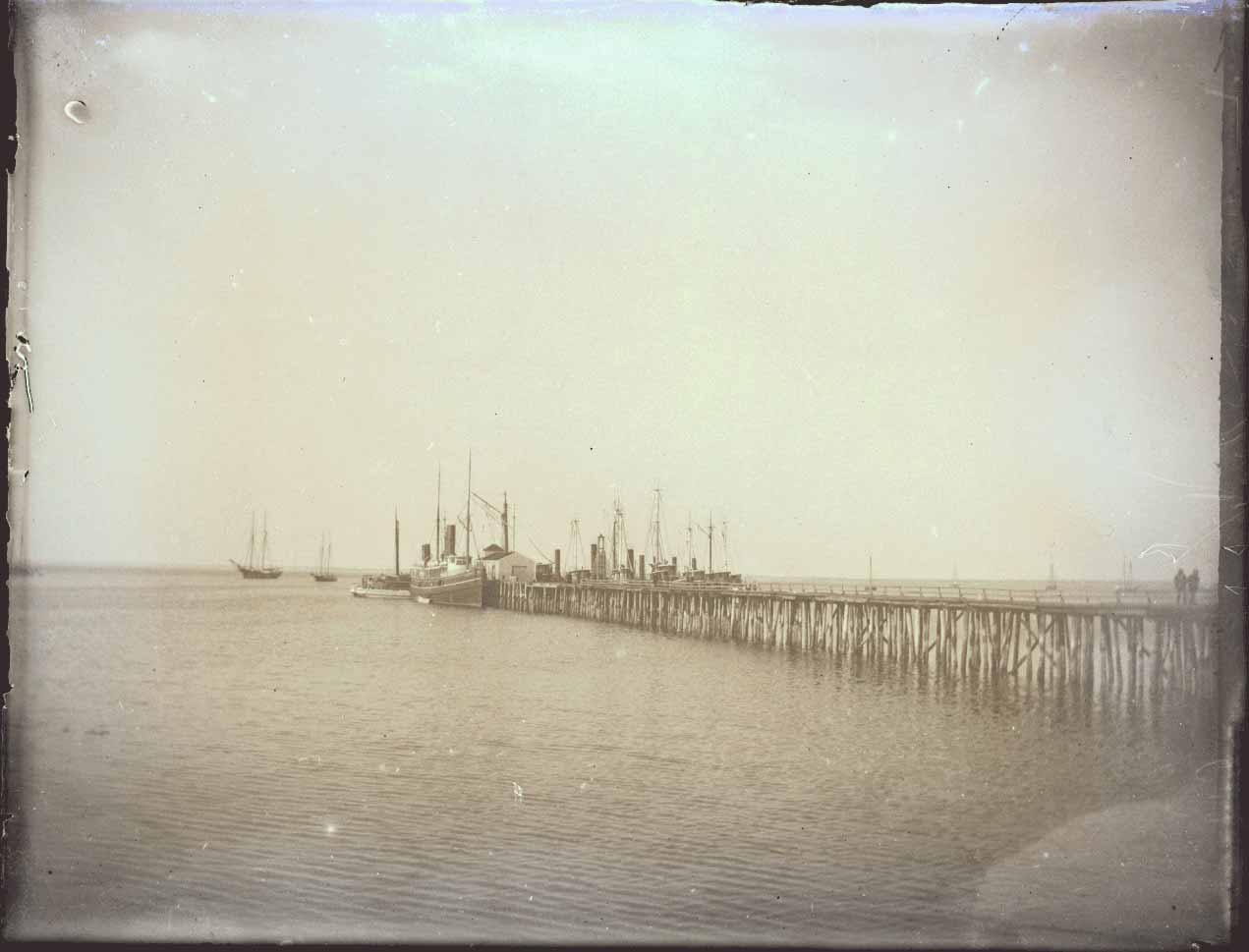
Pogy boats.
As the Map Center’s exhibition Building Blocks creatively demonstrates, historic urban atlases can help tell important stories about the cities we inhabit. Although Atlascope—the Center’s tool for digitally exploring urban atlases—only contains maps from the Greater Boston area, we have been working through 2023 to change that by georeferencing towns like Hull, Lynn, Salem, Fall River, and more. At the very end of the Cape lies one of the towns that a town that means something a little different to many different individuals.
For many, Provincetown (often known colloquially as “Ptown”) has long been haven for the LGBTQ+ community. Some may know it for its decades-old art scene, and for its history, heavily informed by its geographic situation at the edge of the continent. Whoever you are, nobody can deny that Ptown is rich with hundreds of various stories.
Both the Wampanoag and Nauset peoples lived on the land that would become Provincetown at least six-hundred years before the arrival of the Mayflower. Ptown was the landing point for the boat in 1620, where they stayed for around a month, incited a “skirmish”1 with the Pamet peoples, signed the Mayflower Compact, and moved onto Plymouth.
Ptown began to mature during the 19th century, with the advent of the whaling industry; its position, with easy access to the Massachusetts Bay and the Atlantic, made it the perfect place for the whaling and fishing business to set up shop. John F. Murphy’s map of steambout routes in Boston Harbor, for example, depicts Provincetown as a distant but present mark within Boston’s rapidly growing urban system at the turn of the 20th century.
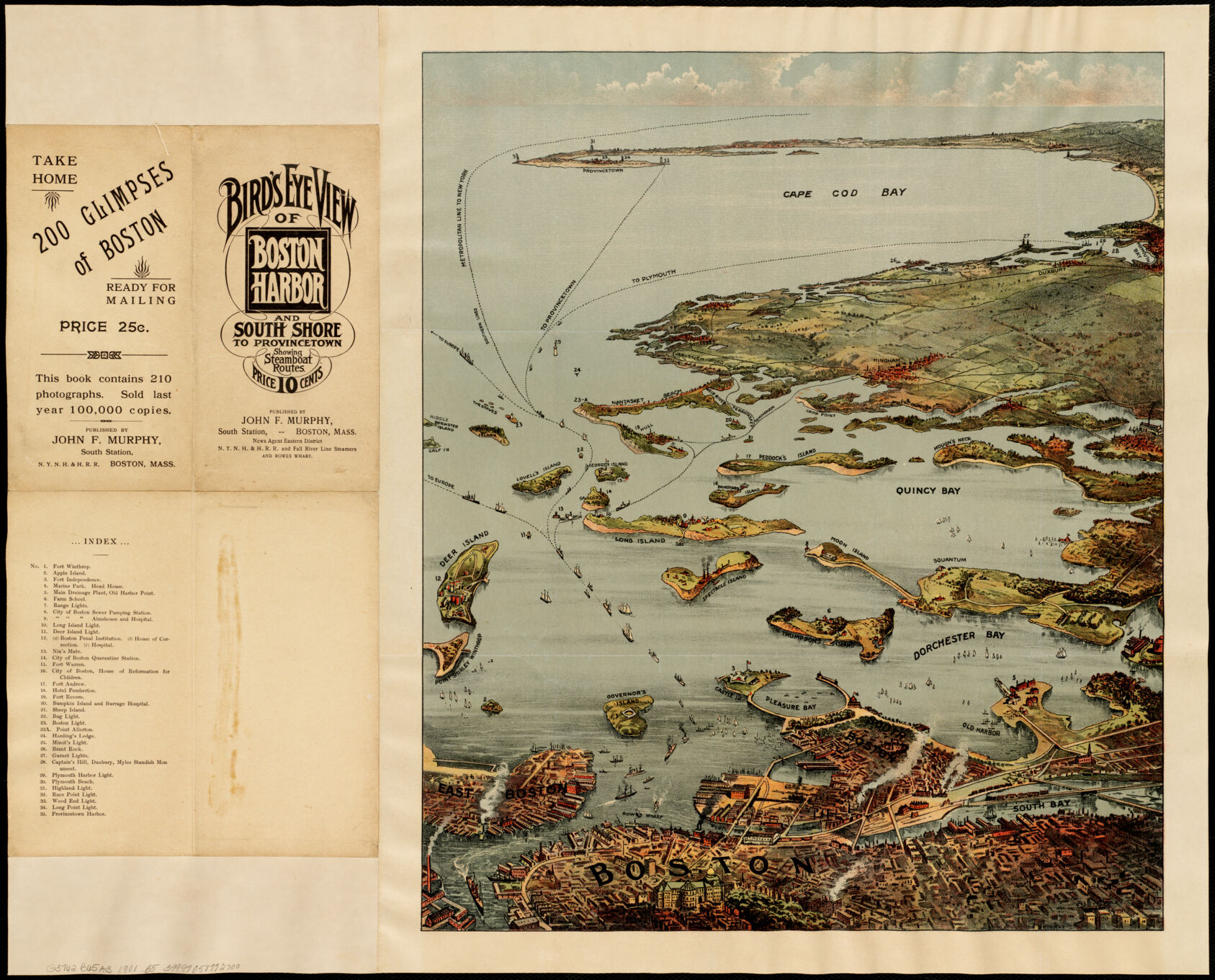
John F. Walker’s Bird’s Eye View of Boston Harbor and South Shore to Provincetown.
Towards the end of the 1800s, the whaling industry had fallen into a steady decline, but not before attracting numerous Portuguese immigrants to the area. Mostly fishermen, they hailed from from the Azores and grew to dominate the fishing industry in the town, over time bringing their families as well as the Catholic Church to P-town. To this day, the town retains a prominent Portuguese community, celebrated in the annual festival and present throughout the town’s restaurants and bakeries.
P’town representing freedom
When Charles Hawthorne opened the Cape Cod School of Art in the town in 18992, the town’s story as an artist’s haven opened. Artists of all kinds were attracted to the towns character, and by the onset of World War I, many writers, artists and playwrights alike called the town home, enjoying the town’s freedom and acceptance. The town retains the same art scene today; artists living in the town in 1914 founded the Provincetown Art Association, and the association along with its associated museum still exist today. The Museum is, today, the most visited museum on Cape Cod.
The town’s welcoming atmosphere and air for freedom also helped make the town a haven for the LGBTQ+ community. By the 1960s, members of the community had found Provincetown including during the AIDS crisis, which Jeanne Braham and Pamela Peterson describe in their book. It was a difficult task for anyone looking to support, as newspapers [*https://www.digitalcommonwealth.org/search/commonwealth-oai:vm412f494] from the time reveal. People of the town persisted through it, organizing conferences [*https://www.digitalcommonwealth.org/search/commonwealth-oai:vm412g792] and creating resources to hand out detailing how others could assist and prevent the disease from spreading further.
Urban atlases
The Leventhal Map Center is home to a great number of urban atlases - historic atlases with highly detailed information about the way urban areas once looked. Provincetown’s downtown area was also charted several times in the early history of urban atlases. Much of the downtown area remains the same as it is today - Commercial Street representing a hub of activity by the water as it does today, and those who know the town well may even spot some modern day favourites on maps from the 1910s.
Noticeable absences today, however, include the railway and the numerous fishing piers. The New York and New Haven Railroad was a vital link in the days of the fishing industry in P’town - both now not major parts of the P’town economy, although both did help put P’town on the map. See for yourself using ‘Provincetown Through the Years!’
Footnotes:
Our articles are always free
You’ll never hit a paywall or be asked to subscribe to read our free articles. No matter who you are, our articles are free to read—in class, at home, on the train, or wherever you like. In fact, you can even reuse them under a Creative Commons CC BY-ND 2.0 license.