Last year, the Leventhal Map & Education Center rolled out a new program to support small grants for early career digital publications. We’ll be publishing the outputs from their exciting work—which will include researched articles, interactive digital maps, and annotates map stories—beginning in June 2023. Until then, you can read below to learn more about the projects and the brilliant minds behind them!
Chloe Bordewich and Lydia Harrington
Boston’s Little Syria
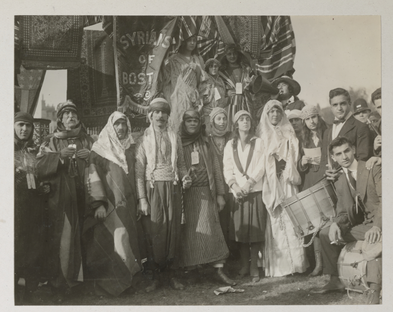
Boston’s Little Syria thrived between the 1880s and 1950s in today’s Chinatown and South End, yet few Bostonians are familiar with it. To raise public awareness of the neighborhood’s past, present, and future, we are creating an annotated, interactive digital map built on local property maps in the Leventhal Center’s Atlascope. Visitors will take a virtual tour through the cityscape and material culture and interact with objects pinned to the map, including artifacts, photographs, oral histories, local Arabic newspapers, and memoirs. The project will contribute to public understanding of Boston as a city with a diverse past that includes a rich Arab-American history.

Syrians of Boston gather on Boston Common for the 1918 Liberty Loan Drive.
Chloe Bordewich earned her PhD in history and Middle Eastern studies from Harvard University in 2022. Interested in histories of empire, technology, and public access to knowledge, she is a 2022-23 Postdoctoral Associate in Public History at Boston University’s Center for Antiracist Research. Lydia Harrington earned her PhD from Boston University’s History of Art and Architecture Department in 2022 and is a Postdoctoral Fellow in the Aga Khan Program for Islamic Architecture at MIT in 2022-2023. She works on the history of institutional architecture and craft education in the late Ottoman Empire and its successor states. As co-leaders of the Boston Little Syria Project, Harrington and Bordewich have led neighborhood walking tours and public events. They have curated exhibitions at MIT’s Rotch Library (December 2022-March 2023) and the Massachusetts Historical Society (April 2023).
Claire Dunning
Mapping Renewal, Engaging Residents
With support from the Leventhal Map and Education Center, Dunning’s project “Mapping Renewal, Engaging Residents” explores maps as useful objects that Bostonians interacted with in the planning processes for urban renewal in the 1960s. In particular, it pairs maps from the Boston Redevelopment Authority for the Washington Park renewal area (held in the LMEC collection) with photographs (held in Northeastern University’s archives) of those maps on display at a local nonprofit, Freedom House, during community meetings.

This map of Washington Park was part of a loan application submitted to the US Urban Renewal Administration in the 1960s.
The digital essay builds from her recent book to consider how interacting with maps became a way for traditionally marginalized and minoritized residents to engage with their government, shape the future of their neighborhood, and participate in planning.
Claire Dunning is an assistant professor at the School of Public Policy at the University of Maryland, College Park, where she is also an affiliated faculty member in the History Department. She is a historian of the United States in the 20th century, focusing on the histories of poverty, inequality, governance, and nonprofit organizations in American cities. Her work has been published in several scholarly journals and reached popular audiences in the Boston Globe and Washington Post. Dunning is the author of Nonprofit Neighborhoods: An Urban History of Inequality and the American State (University of Chicago Press, 2022), a book about local consequences of pursuing a public good through private organizations. She holds a PhD in history from Harvard University and an AB from Dartmouth College, and was a postdoctoral fellow at Stanford University.
Nathan Braccio
John Winthrop’s “City on a Hill”: Mapped

A facsimile copy from LMEC collections of John Winthrop’s map of the Massachusetts bay.
John Winthrop’s “City on a Hill”: Mapped will be an annotated tour of a 1630s map of Massachusetts Bay made by the Puritan leader, John Winthrop. The tour will guide viewers through different textual and symbolic elements of the map and discuss the murky history around its creation. Viewers will learn about the culturally specific ways that colonists imagined New England in the early 1600s. Particular attention will be paid to the ways that Winthrop largely erased the robust presence of Indigenous people in the area his map covers, and what cultural assumptions informed this decision. This will help viewers consider the ways in which mapmakers continue to erase Indigenous people and knowledge. However, the tour will also explore how Indigenous power shaped Winthrop’s understanding of New England, as Algonquian leaders and guides determined where colonists could and could not access.
Nathan Braccio is an Assistant Professor of History at Lesley University. He received his PhD from the University of Connecticut in 2020 in American History and has published multiple articles on the history of English and Indigenous mapmaking in 1600s New England. More on Nathan can be found on his website, nathanbraccio.com, and you can find some of his work on Indigenous mapping here and here.
Deland Chan
Navigating ‘Marginality’ Through Infrastructures
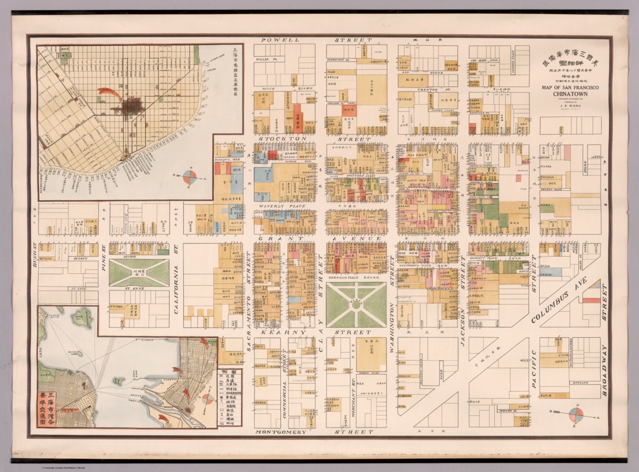
Deland Chan is a doctoral candidate in Sustainable Urban Development at the University of Oxford. Her project at LMEC, “Navigating ‘Marginality’ through Infrastructures,” examines the lived experiences of urban infrastructure associated with the Chinatown Central Subway in San Francisco. This research is part of a broader dissertation book project focused on community planning efforts in San Francisco’s Chinatown to secure affordable housing, transport, and sustainability initiatives. Her research draws from ethnography, interviews, archival research, and community-based methods. It aims to nuance notions of how low-income communities facing threats of gentrification and displacement can shape the future of their neighborhoods.

Mei guo san fan shi hua qiao qu : xiang xi tu = Map of San Francisco Chinatown, from David Rumsey Map Collection.
Outside of research, Chan taught courses in urban sustainability, urban studies, and planning in the Program on Urban Studies and d.school at Stanford for a decade. She also founded several youth programs, the Chinatown Urban Institute and the SF Young Planners program through the San Francisco Planning Department, to build community-based research capacity and a pipeline of planners from communities facing gentrification and displacement. Chan holds a B.A. in Urban Studies, M.A. in Sociology from Stanford University, and a Master’s in City Planning from UC Berkeley. She is a member of the American Institute of Certified Planners, a LEED Accredited Professional, and previously served on the San Francisco Planning Commission from 2020-2022. As of May 1, 2023, Chan will serve as the Director of Research at the Chinatown Community Development Center.
Julian Hartman
Section 112 Credits in Boston and Cambridge

Illustrative site plan for the Fenway urban renewal area, from LMEC collections.
Julian is a PhD candidate at the University of Arizona School of Geography, Development and Environment. His research examines urban development in the Boston region, tracing how university and medical institutions, entrepreneurial urbanism, and persistent racial inequality have interacted to shape Boston’s emergence as a global city in the past 75 years.
In this project, he maps the use of so-called Section 112 Credits in Boston and Cambridge. Section 112 Credits were a financial mechanism used in the 1960s to enroll universities and hospitals in the project of urban renewal. Certain institutional expenditures were allowed to count towards a city’s local expenditure on urban renewal, triggering a 2-to-1 federal match (in most cases). In the Boston region, credits were generated in the South Cove, Fenway, and Kendall Square neighborhoods. While credits were intended to increase the influence of institutions in the urban planning process, Section 112 projects often led to neighborhood and community resistance which asserted the legitimacy of community planning over institutional interests. Julian’s research compares different Section 112 projects in the region in order to understand how these credits impacted the conflictual negotiations between communities and institutions about how to plan their shared neighborhoods. He believes this topic holds lessons for building effective planning partnerships between communities and institutions in the future.
Tieanna Graphenreed
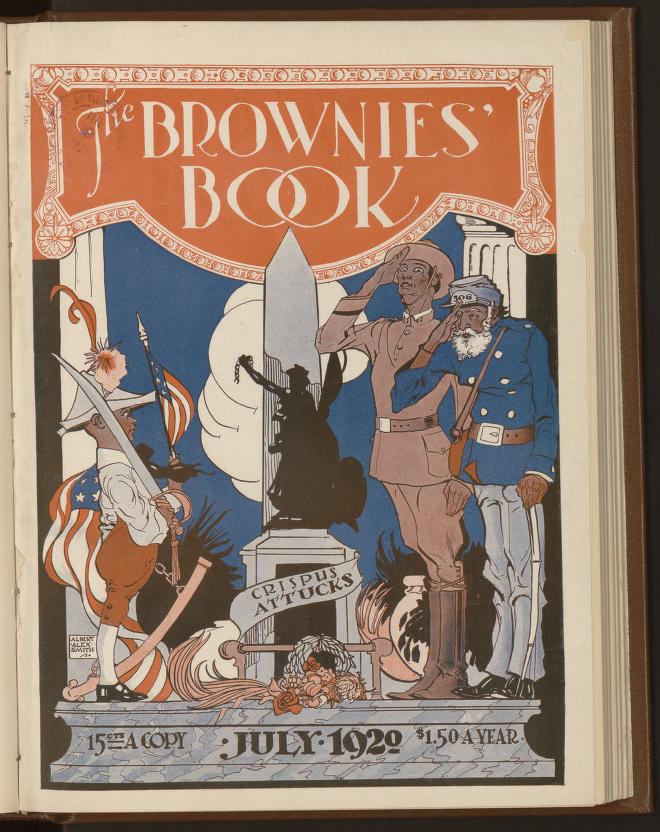
Mapping The Brownies’ Book

A 1920 cover from the Brownies’ Books featuring the Crispus Attucks monument in the Boston Common, from the Library of Congress.
Tieanna Graphenreed is an English PhD student at Northeastern University studying rhetorics of Black citizenship and Black spatial politics. Tieanna’s research explores questions of rhetorical citizenship through lenses of writing studies and civic rhetorical education, critical geographies of race and space, and digital humanities. Her dissertation focuses on building a digital index and web-based learning resource focused on The Brownies’ Book and its import to U.S. Black education histories. Tieanna Grapheneed is Managing Editor for Reviews in Digital Humanities.
While at Northeastern, Tieanna has worked on digital projects with the Early Caribbean Digital Archive (ECDA), Early Black Boston Digital Almanac (EBBDA), and Mapping Black London (MBL); she has also served as Assistant Director of the Writing Center, and developed and led workshops on various digital tools with the NULab for Texts, Maps, and Networks and the Digital Integration Teaching Initiative.
Tieanna’s most recent article in Composition Studies, co-authored alongside Professor Mya Poe, engages writing assessment research to consider classroom ecologies and forward antiracist genres and antiracist assessment practices in the classroom.
Joan Brunetta and Eve Loftus
Black Presence in Early Cambridge, 1790-1820
This project is jointly supported by the Harvard Map Collection at the Harvard Library.

A 1795 plan of Cambridge, from Massachusetts Archives.
Joan Brunetta and Eve Loftus both grew up in Cambridge and went on to study History at Smith College. Eve has recently finished an M.Phil. in Public History and Cultural Heritage from Trinity College Dublin, and is interested in the decolonization movement in museums and increasing and improving public access to local history. Joan is an aspiring archivist and studied American history at Smith before earning her Master’s in Medieval Studies from the University of York (UK). She is equally interested in American social history and ancient languages. Despite their varied interests, both continue to find their way back to Cambridge to explore its history, and are excited for this opportunity to create a resource that will hopefully augment Cantabridgians’ understanding of their own city.
Their project aims to make an accessible map showing the homes Black families and individuals across Cambridge between 1790-1820. To do so, they are cross-referencing the first four US censuses (1790, 1800, 1810, and 1820) with vital records, church records, directories, newspapers, and other contemporaneous documents. With this work they hope to increase the available information about these people and families and to demonstrate Black presence in early Cambridge.
Our articles are always free
You’ll never hit a paywall or be asked to subscribe to read our free articles. No matter who you are, our articles are free to read—in class, at home, on the train, or wherever you like. In fact, you can even reuse them under a Creative Commons CC BY-ND 2.0 license.